Monday 10 September 2012

Your comments are welcome!


We hope you enjoy reading our blog and do not hesitate
to post your comments and feedback!  Carrie and Sandra


Day 1 in Idaho Springs, CO.
August 2012:  Two friends, Carrie and Sandra, set off on a 2 week independent cycling trip across Colorado, USA. 

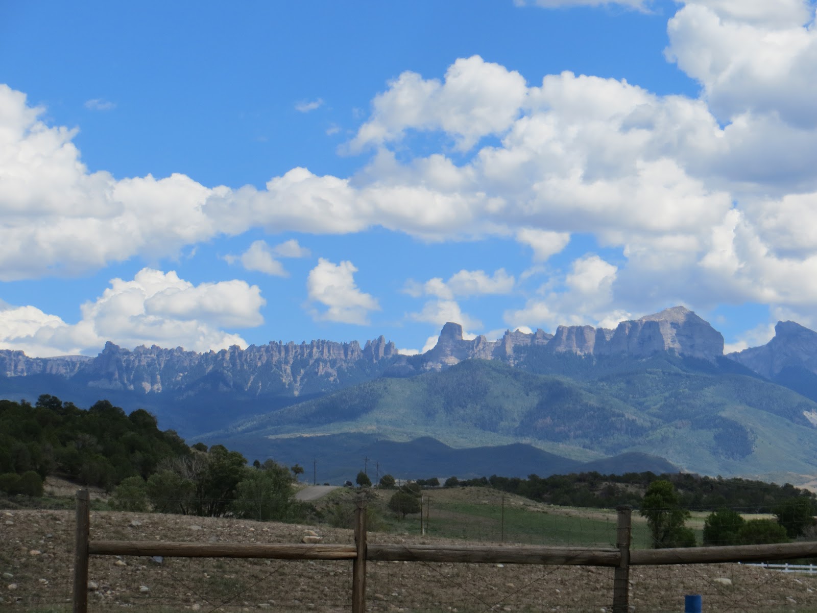
Our adventure began in Idaho Springs and we cycled over 1,000 kms experiencing challenging climbs and scenic descents through the Rocky Mountain National Park, Frisco, Breckenridge, Salida, Gunnison, Montrose, Telluride, Mesa Verde National Park, Cortez and more!

We thoroughly enjoyed our cycling trip and would recommend it to anyone who is looking for an adventure - visit the Adventure Cycling Association for inspiration to start your trip with a wide range of maps available!


You can also read about our side trips to Monument Valley Navajo Tribal Park and the Grand Canyon National Park where I hiked from the South Rim to the North Rim.


Friday 7 September 2012

Mesa Verde NP to Cortez

Contemplating the descent down from Mesa Verde National Park to Cortez, CO - the end of the cycling trip!

Day 13 - Mesa Verde and Cortez.

We cycled just over 1,000 kms across Colorado!
Today is the last day of our cycling trip!  We have a short ride cycling just over 30 kms on highway 160 - straight to Cortez.

We left Morefield Campground and enjoyed a scenic descent to the bottom, before following the highway into Cortez.

Reaching Cortez signaled the end of the cycling trip and we took a few commerative photos by the welcome sign and felt proud of ourselves for reaching the end without having any punctures or accidents!


We celebrated over lunch and then headed over to the Kokopelli Bike Shop in downtown Cortez to drop the bikes off as the owner kindly agreed to ship the bikes back to New World Sports bike shop in Fort Collins. 

The guys at Kokopelli were extremely helpful and we would highly recommend them!

Kokopelli Bike Shop in Cortez, CO.
Now we seperate and start another adventure! 

Please click the links on the left hand side to read our trips to Monument Valley and the Grand Canyon National Park.

Starting point: Mesa Verde National Park, CO
End point: Cortez, CO
Total distance 32 kms

Thursday 6 September 2012

Dolores to Mesa Verde National Park

That is where we are heading! Pointing to a steep climb up to Mesa Verde National Park!
 
Day 12 - Dolores, Mancos and Mesa Verde National Park.
 
A relatively easy day, covering about 60 kms along highway 184 all the way to Mancos, then highway 160 to Mesa Verde National Park.

We left Dolores early and decided to travel to Mesa Verde via Mancos.   After a 16 mile ride we arrived and found a great breakfast place ‘Absolute Bakery’... once again, it is all about the food on this trip! 


Entrance to Mesa Verde National Park.
After a short 5 mile ride from Mancos, we arrived at Mesa Verde National Park and as soon as we had passed through the entrance it was an extremely steep climb up to the campground.  With the climb over with, we set up our tents and cycled out of the campground leaving all our gear for the first time...it felt amazing!   

The first stop was the Visitor Centre, involving yet another steep climb and at this point we surrendered and caught a lift up with some friendly tourists!  We spent the next few hours cycling around some of the sites and visited the museum. 
 
Cliff Palace View lookout in Mesa Verde National Park, CO.

Mesa Verde National Park - "It offers a spectacular look into the lives of the Ancestral Pueblo people who made it their home for over 700 years, from A.D. 600 to 1300. Today the park protects nearly 5,000 known archaeological sites, including 600 cliff dwellings".  Source: National Park Service.

Incidentally, we got chatting to one of the rangers who remarked that tourists often ask if there are any more 'undiscovered' ruins?!


One of the many cliff dwellings of the Ancestral Pueblo people in Mesa Verde National Park, CO.
It is easy to spend a few hours in the park and after touring around we were hit by the fact that the only way to the restaurant is a 5 mile climb up!  We hadn't accounted for the extra distance we cycled in the park, so we tried in vain to get another lift but it didn't work and we struggled up the hill and had a well deserved dinner!

By the time we left it was starting to get dark and due to the amount of wildlife, it is not safe to cycle back so we got a lift from the staff shuttle.

Beautiful lookout point in Mesa Verde National Park, CO.

Starting point: Dolores, CO
End point: Mesa Verde National Park, CO
Total distance 72 kms
Campground: Morefield campground

Wednesday 5 September 2012

Telluride to Dolores


Day 11 - Telluride, Rico, Stoner and Dolores.

We are cycling over 90 kms today along highway 145, all the way to Dolores.  We have a steep climb up Lizard Head Pass (10,222), where we follow the Dolores River all the way to our motel.
 
We woke up to discover that it is a great place to explore and we couldn't resist taking the free gondala up to see the town.  The views are amazing and it is well worth the trip. 

Beautiful views in Telluride, accesible with the free gondola from Telluride, CO.
Once out of town we had a hectic climb ahead, which was made worse by the fact that we realised that we could have taken our bikes up the gondola and avoided the climb!  Slow and steady is the name of the game and once the climb was over, we cycled down into Mountain Village and then up  ‘Lizard Head Pass'. 


The climbs get a lot easier and once at the top, the sense of achievement is worth it!

The scenery in this area is beautiful and after a quick 12 mile downhill cycle to Rico, we were both starving and found a great diner with the best philly cheese steak sandwiches!

After lunch we enjoyed a 38 mile descent all the way to Dolores, covering the distance quickly and arrived in Dolores just before 7pm.

With no accommodation booked (we found it difficult to find places to stay here), we did a quick fly-by of the town and settled on a cheap and cheerful motel cabin room and enjoyed dinner at a local  brewery.

Starting point: Telluride, CO
End point: Dolores, CO
Motel:  Motor Inn
Total distance:  104 kms

Tuesday 4 September 2012

Montrose toTelluride

The scenery in Colorado is breathtaking.

Day 10 - Montrose, Colona, Ridgeway, Placerville, Sawpit and Telluride.

We are cycling around 70 kms today - taking highway 550 to Ridgeway, highway 62 to Placerville and finally following 145 to Telluride.


Welcome to Ridgeway, CO.
After being hosted for the night, we were up early and driven to see the local sights of Black Canyon National Park. 

Once back on the road, we followed 550 to Ridgeway, which is mostly downhill all the way.  It was a lovely hot day, so we stopped in Ridgeway and saw the 'True Grit' bar before we started an uphill climb to Placerville!

This area of Colorado is stunning and I often found myself pulling over and taking lots of photos.


For the first and only time on the trip, we lost each other and in all the confusion we ended up cycling the extra distance to Telluride.  With no accommodation booked, we spent the night in a great hotel.

Starting point: Montrose, CO
End point: Telluride, CO
Total distance 104 kms
Hotel:  Victoria Inn

Monday 3 September 2012

Gunnison to Montrose

Great day cycling from Gunnison to Montrose - spoilt for scenery!

Day 9 - Gunnison, Sapinero, Cimarron and Montrose.

We have a big distance to cover today - cycling over 100 kms following highway 50 all the way.

It was a cold morning, so when we finally managed to drag ourselves out of our warm sleeping bags, we  cycled the short distance into Gunnison for a warm breakfast! 

Warmed up, we stayed on highway 50 all the way to Montrose, cycling alongside the Gunnison River for almost half of the journey. 


Despite being on the highway for the entire day, the scenery in this area is stunning.  You also realise that being on the bike makes you appreciate the views so much more than if you were driving in a car. 

I am offically hooked on touring places on a bike, I just wish I started earlier!


Starting point: Gunnison, CO
End point: Montrose, CO
Total distance:  107 kms
Campground: Hosted!

Sunday 2 September 2012

Salida to Gunnison


Day 8 - Salida, Poncha Springs, Maysville, Garfield, Sargeants, Doyleville, Parlin and Gunnison.

 
Today we are cycling
98 km through many small towns.  Once out of Salida, we are back on highway 50 all the way to Gunnison, with a steep climb up Monarch Pass (elevation 11,312).


Starting point: Salida, CO
End point: Gunnison,CO
Total distance:  98 kms
Campground: Tall Texan Campground

Saturday 1 September 2012

Fairplay to Salida


Day 7 - Fairplay, Johnson Village, Nathrop and Salida.

Todays journey covers an easy 70 km route, with a long descent from Fairplay on highway 285, taking us nearly all the way to Salida.  We only have one small climb up Trout Creek Pass (9,346' elevation).


We woke to a cold morning in the campground and headed straight to Johnson Village for breakfast.

As most of the ride was downhill, we had managed to cover over 35 km by early morning!


The views today were amazing, with some of the most scenic downhill yet throughly enjoyed with no steep hills to climb!  


We took highway 291 to Salida and with plenty of time to enjoy the town, we stopped at a few coffee shops and relaxed for a few hours before leaving for the campground.


Starting point: Fairplay, CO
End point: Salida, CO
Total distance: 72 kms
Campground: Heart of the Rockies Campground

Friday 31 August 2012

Silverthorne to Fairplay

Riding along the bike path from Silverthorne to Breckenridge, CO.
 
Getting lost and confused outside Silverthorne!

Day 6 - Silverthorne, Frisco, Breckenridge, Blue River, Alma and Fairplay.
 
Today we are following a fairly steady 88 km ride through various tourist towns, with side roads and bike paths available all the way to Breckenridge.  Once out of Breckenridge, we have a climb up Hoosier Pass (11,542' elevation), followed by a descent into Fairplay.


We left Silverthorne early to look for the bike path to Frisco, but we were unable to find it so we accidently found ourselves starting our day on interstate 70.  Luckily we were promptly pulled over by a local police officer and were politely advised that we shouldn’t be on the interstate, mam


We made a quick u-turn (chaperoned by our police officer) and eventually located the 16 mile bike path that took us all the way into Breckenridge.  It is a great scenic ride and a welcome change from cycling on the highway. 

We stopped for lunch and a walk in Breckenridge (great town to spend a few hours), before once again crossing the Continental Divide to our next mountain pass, 'Hoosier Pass' (elevation 11,539 ft).

Hoosier Pass’ is a 4 mile climb and by this point I am starting to get a bit cocky...the climbs are getting easier and even enjoyable!
 
From Hoosier Pass, we enjoyed a nice descent and bike road into Alma. Once in Alma, our next stop was ‘Airways’ which we discovered is the inspiration for South Park!

Our highlight was the ice-cream shop and the Mexican takeaway that was opposite, making for a great dinner at the campground!

We had an easy descent into Fairplay, covering over 15 miles in less than an hour!  We arrived at the campsite just after six o'clock and as it was Labour Day weekend there were plenty of people to talk to around the camp fire.
 
Starting point: Silverthorne, CO
End point: Buffalo Springs, CO
Total distance: 88 kms
Campground: Buffalo Springs Campground

Thursday 30 August 2012

Empire to Silverthorne

 
Day 5 - Empire, Georgetown, Dillon and Silverthorne.

We are covering a shorter distance of 70 km today, starting with a climb from Empire all the way to 'Loveland Pass' (11,990'), followed by a long descent to Dillon and Silverthorne.

We woke up feeling refreshed after spending a night in a comfortable hotel and after a slightly tricky  navigation out of Empire, we were guided onto a gravel road which took us all the way to 'Georgetown' (population 1,034).

Georgetown is a picturesque town with lots of history...it is like stepping back in time!

The main street in Georgetown, Colorado.


We climbed Loveland Pass (elevation 11,990 ft), once again crossing the Continental Divide.

It was a difficult climb but all is forgotten when you get to the top!   We had time for a quick picture, then were back on the bikes for a wet and windy descent to Dillon and Silverthorne. 

Once we got to Silverthorne it started pouring down so we decided that camping wasn’t an option...which leaves only one thing to - find a motel!

We checked in to Super 8 and were pleasantly surprised when we informed by reception that we were only 5 minutes from an outlet mall...what's a girl to do?! 

Starting point: Empire, CO
End point: Silverthorne, CO
Total distance: 62 kms
Campground: Heaton Bay Campground
Motel:  Super 8

Wednesday 29 August 2012

Grand Lake to Empire


Day 4 - Grand Lake, Granby, Fraser, Winter Park and Empire.

Today's 85 km ride is mostly uphill, following highway 40 all the way to 'Berthoud Pass' (11,315') and then descending into Empire.

After a cold start, we packed up and headed 6 miles to Granby with one thing on our mind - a warm breakfast!


With our bellies full we headed out on highway 40 and as we were keen to get off the highway, we followed the ACA map and took 'Country Road 5' - a 6 mile scenic ride straight to Fraser (population 1,224). 


We passed through Winter Park (population 999) and decided to stop for lunch and with lots of empty tables we jumped at the opportunity to dry our tents and soak up some sun!

Once out of Winter Park, we started the ascent up Berthoud Pass, crossing the Continental Divide for the second time. 


Once at the top of Berthoud Pass, we were rewarded with an 11 mile descent, conveniently arriving right outside our accommodation for the night!

We settled in to the hotel and made the most of our first night not camping ....you had me at hot shower and dinner!


Starting point: Grand Lake, CO
End point: Empire, CO
Total distance: 84 kms
B&B: The Peck House

Tuesday 28 August 2012

Rocky Mountain National Park to Grand Lake

Enjoying the view in the Rocky Mountain National Park, after a long climb up on Trail Ridge Road.

Day 3 - Rocky Mountain National Park, Grand Lake and Granby.

Today is one of our most challenging days cycling 80 kms on highway 34, which is also known as 'Trail Ridge Road'.  From our campground, we climb for 23 miles to the Visitor Centre and climb 'Milners Pass' (10,758 elevation), followed by a 23 mile descent all the way to Grand Lake.


Trail Ridge Road is the highest continuos highway in the USA.
Visting the Rockies is one of the highlights of our trip.  We will cycle along 'Trail Ridge Road' - America's highest continuous highway. 

12,183’ above sea level, there was never a dull moment with breathtaking scenery. 

We had plenty of time to soak it all up as there were many stops on the ascent, allowing us to minmize any altitude effects - and get our breath back!


We enjoyed a slow winding ascent through the park, making a marker for a lunch spot and had a great break at the view point.  We continued up and passed another viewpoint - where I have to confess we tried to get a lift as the weather was starting to look a bit grim...we failed and had to climb anyway!


Continental Divide


2 miles above sea level inside the Rocky Mountain National Park.

We crossed the 'Continental Divide', which according to the explanation below is...

“An imaginary geographic line defined by the fact that water poured on one side of it would ultimately flow into the ocean on one side of a continent, while water poured on the other side of the line would flow into the ocean on the other side of the continent”. 


It was a slow climb to the Visitor Centre and with the weather getting worse, it made it feel even harder!  Once at the top,  we enjoyed the long descent down surrounded by beautiful scenery all the way to the Visitors Centre.

It was a bit of a trek to the campground, but we made it with about 30 mins of sunlight and the campground had lovely hot showers!

Starting point: Rocky Mountain National Park, CO
End point: Grand Lake, CO
Total distance: 80 km
Campground: Stillwater Campground